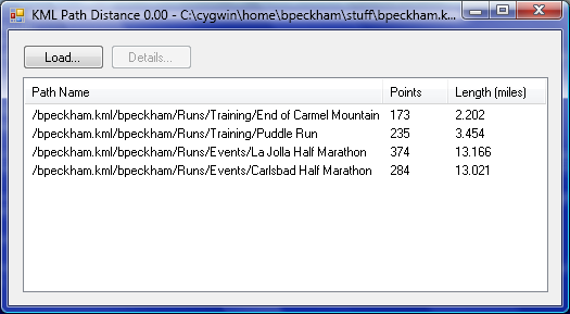
KML Path DistanceGoogle Earth allows a user to create and save a path, but the path tool is missing a crucial feature: it doesn't compute the length of the path. The program also has a measuring tool that can compute the length of a path, but this path cannot be saved. Go figure. Enter KML Path Distance. This program reads a KML file, finds all the paths in the file, and displays the length of each path. Screenshot:
 How to use.
This program requires .NET Framework. |